


High-tech imaging can be useful eco-tool |20 December 2004
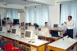
A four-day training session at the National Institute of Education brought representatives from the two island countries together as part of a project stemming from the Assessments of Impacts and Adaptations to Climate Change (AIACC). A facilitator from the Indian Institute of Technology in Mumbai led the course.
The AIACC is a global initiative looking at the effects of climate change and how countries are adapting. Two field studies to see how climate change is affecting tourism in small islands are currently being conducted in Seychelles and Comoros as part of the AIACC project.
Satellite images and aerial photos can go a long way toward solving real environmental problems on the ground, said Justin Prosper of the Geographical Information Systems (GIS) unit in the Ministry of Environment and Natural Resources.
The training session gave the participants an overview of remote sensing and watershed management, two important tools used in GIS, which brings together a number of sciences – like cartography for instance – to produce visual representations of what’s happening in certain areas.
Remote sensing involves stringing together different satellite images over time to understand what’s changing in an environment, such as how a shoreline evolves. Watershed management creates models to predict coastal flooding or sea level rise.
According to Mr Prosper, both tools can be useful for professionals working in a number of different sectors. Participants were drawn from the Public Utilities Corporation, the Ministry of Tourism and Transport and the Seychelles Centre for Marine Research Technology.
Mr Prosper said one participant who is on the national drainage committee, for instance, would be able to use watershed management to get a better handle on the flooding situation some parts of Mahe faced late last year.
The training session would hopefully give the participants a chance “to know what (GIS tools) are available and give them a sense of what needs to be done,” he added.