


Seychelles disaster risk assessment of key buildings available on web |29 August 2018
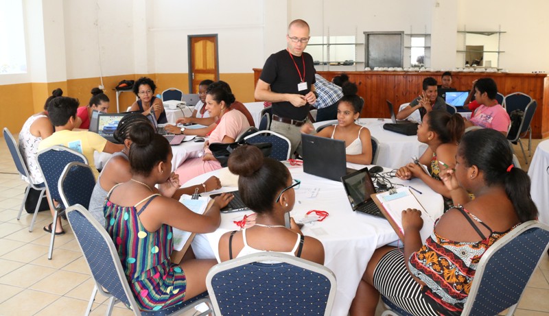
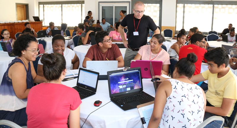
The students during an indoor working session yesterday
Relevant data on disaster risk management of important buildings in Seychelles will soon be available on the website www.openstreetmap.org, for stakeholders and the general public.
A whole week mapping exercise is being carried out in the country whereby relevant risk data on important buildings, vulnerable to natural disasters or others, are being collected to ideally reduce or prevent disaster risk and also for evacuation planning.
Such infrastructure include public buildings, tourism establishments, schools, day care centres, health centres, homes for the elderly, among others.
The mapathon mapping exercise is being conducted by the World Bank, in collaboration with other government partners, especially the Ministry of Education and Human Resource Development (MEHRD), as part of the Open Cities Africa project.
The project is about data and technology for better disaster risk management.
The mapping exercise consisted of three days of data collection (Monday, Wednesday, Friday) and three days of data analysis (Tuesday, Thursday, Saturday).
On Monday, the Open Cities Africa Seychelles Project team, headed by Michael Wagner, led the Open Cities Africa Seychelles Project team for the first mapping exercise at Beau Vallon. The team comprised students and teachers from Mont Fleuri secondary school, Independent School, Anse Royale secondary school and Perseverance secondary school.
Tourism establishments were the main focus for the week’s disaster risk data collection and Beau Vallon area was chosen as a start off because of its high concentration of tourism establishments with high occupancies.
The team collected details such as the locations, distance from the sea, rivers, material used for construction, number of floors, occupancies and evacuation points of the hotels and self catering guest houses in the area.
The same mapping exercise is also taking place on Praslin, which started at Grand Anse, and on La Digue around the La Passe area, by the secondary school students and teachers from both islands.
Yesterday, the students and teachers met at the Education Hall, Mont Fleuri, and fed all collected information into a map database to be published online on the above website for the benefit of stakeholders.
“The reason we are doing this project is to teach the kids how to use maps and the technology around and secondly what they collect is going to be useful for disaster risk management and thirdly we want to build a community of mapping fans here that can contribute more regularly to the Open Street map,” Mr Wagner said.
www.openstreetmap.org is a free map of the world website and Mr Wagner noted that this makes it interesting for schools where they can upload and even download free data for their lessons or any other projects they engage in.
He said to realise the project, the teachers received four days training on Global Information System (GIS) and on Open street map, to train their students. As some students did not have internet accounts, they were helped to create one so as to access the website.
13-year-old Adèle Pillay from the Mont Fleuri secondary school said: “This project is a good initiative for young people as it gives us the opportunity to learn on potential disaster risk that a building faces and also we get to interact with many people which is also good.”
Harry Morel, 16 years, from Independent School, said: “I am very enthusiastic about it. I love mapping. The exercise will enhance my knowledge on all the different places we will be mapping.”
The mapping exercise continues today in South Mahé and on both Praslin and La Digue.
It will end on Saturday.